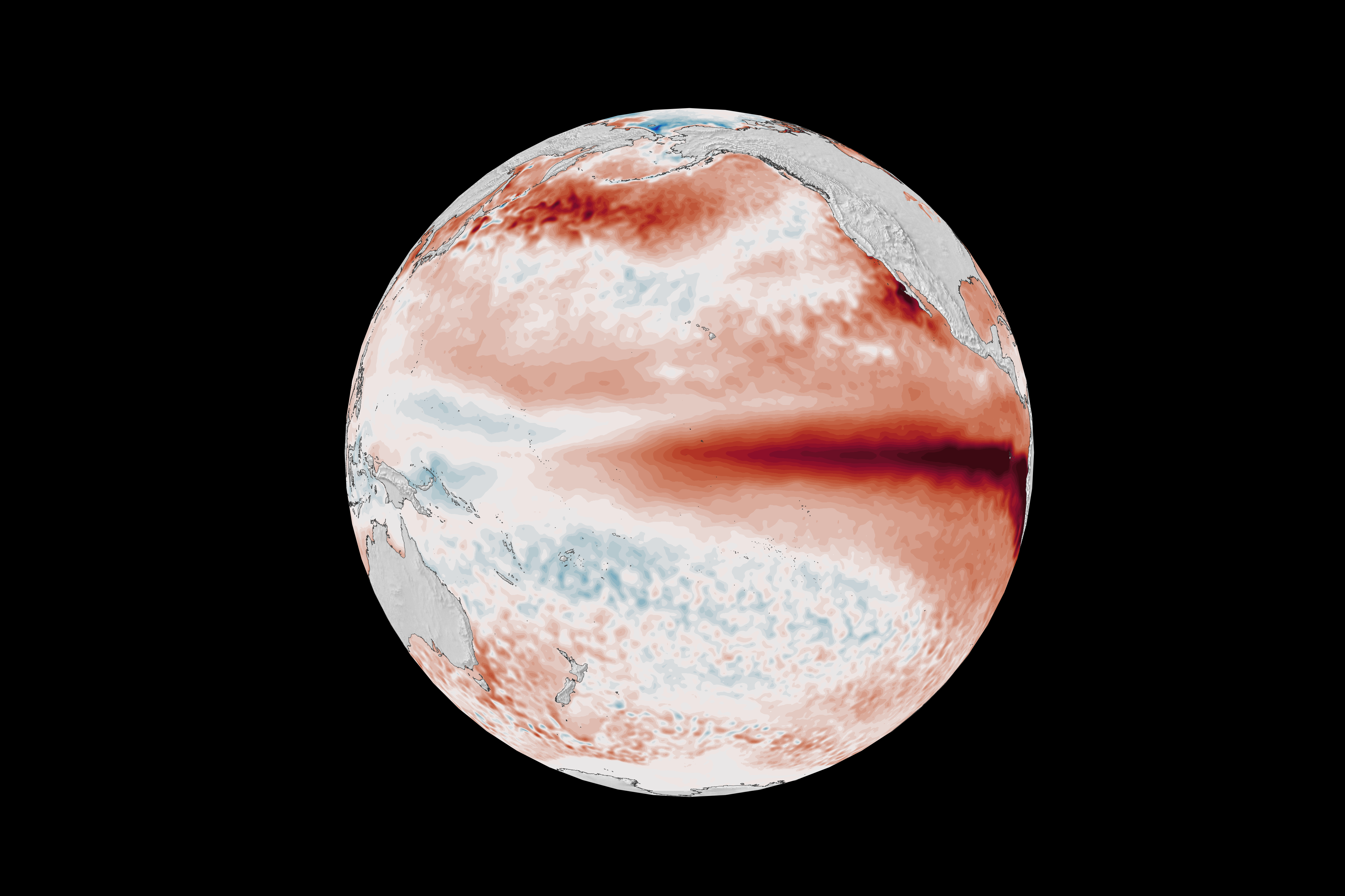
Is there such thing as a ‘Godzilla’ El Niño?
‘Godzilla’ is not one of the labels used in the scientific classification of El Niño strength.
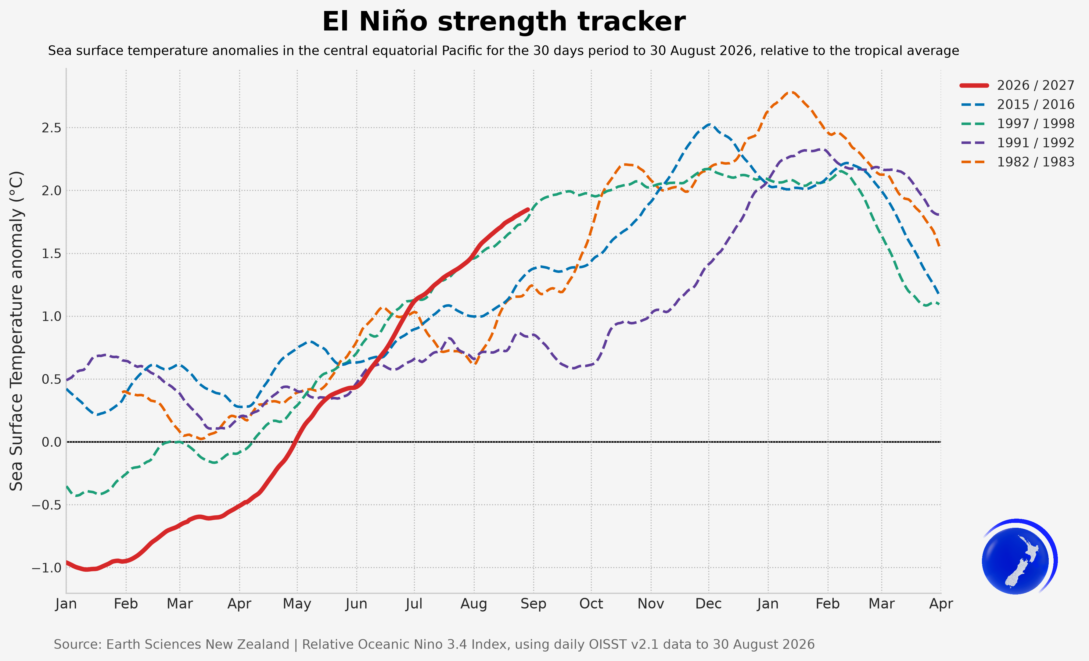
El Niño events are classified according to how much warmer than usual sea surface temperatures are in the Niño 3.4 region of the Pacific:
The classified strength of an El Niño event doesn’t always correspond to the strength of its impact in New Zealand, as our weather is influenced by many factors.
When and how is El Niño declared?
There isn’t one globally accepted definition of El Niño. Different organisations use different indices, time periods for making the assessment, and thresholds.
An El Niño declaration is not equivalent to a government drought declaration or state of emergency. It is a scientific assessment that certain criteria have been met.
At Earth Science New Zealand, El Niño classification incorporates both oceanic and atmospheric indicators:
Earth Sciences New Zealand declared this current El Niño event as part of our Seasonal Climate Outlook released on 2 July 2026.
What does this El Niño event mean for New Zealand?
Spring 2026 is expected to be drier than normal for northern and eastern parts of both islands, with the greatest odds for dryness over northern and eastern parts of the North Island. A windier than usual spring is in store for much of New Zealand, especially for the South Island and lower and eastern part of the North Island. At times, strong wind will drive unusually warm weather, with eastern parts of both islands likely to see spikes in high temperatures, which combined with dryness, will result in increased wildfire risk.
An active, stormy spring is expected for the western and lower South Island, as frequent fronts and low pressure systems bring periods of high wind and heavy rain, and consequently increased chances of flooding.
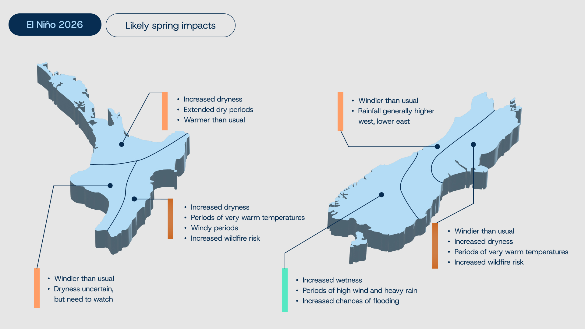 Seasonal Climate Outlook.
What have we seen with historically strong El Niños?
Comparison of the top five historical El Niño events clearly indicates the recurring pattern of an unusually dry summer in the north and east, and wetter in the south and west.
While we know the average outcome of El Niño because of historical data, no El Niño is average. Each comes with a unique set of climate characteristics and therefore can be expected to influence the weather differently.
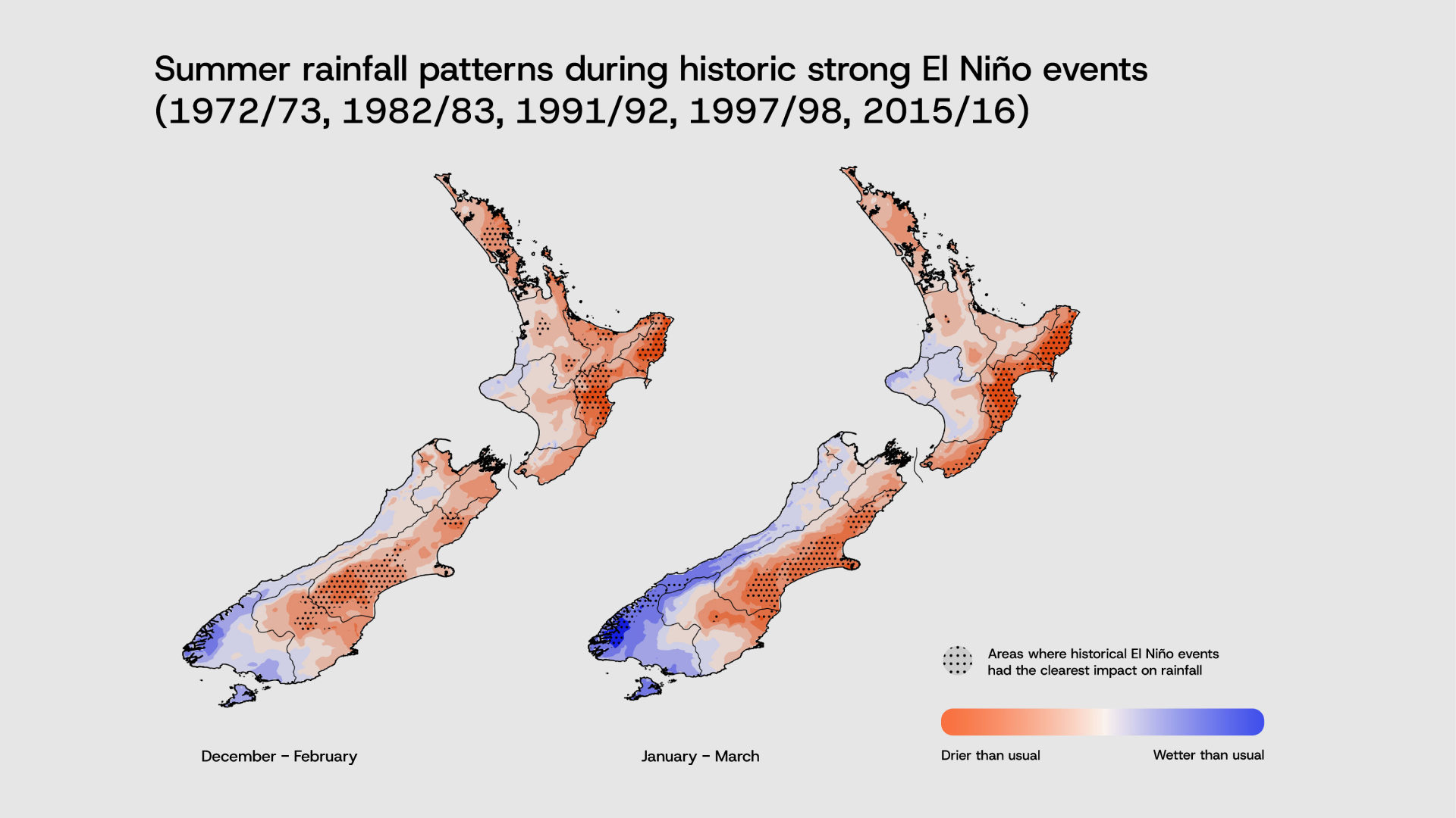
Summer rainfall during past historic strong El Nino events. Dots show where there is the most certainty that El Nino was influencing the rainfall.
How long will this El Niño event last?
Usually, El Niño peaks in the summer, between December and February. The latest forecasts suggest this current El Niño may reach its peak relatively ‘early’, in November or December 2026. Given the strength of the event, a return to ‘neutral’ conditions (neither El Niño nor La Niña) is not expected before April – May 2027.
What impact does climate change have on El Niño ?
There is considerable uncertainty about how El Niño and La Niña will change in a warming climate.
Several climate models suggest a future in which these events become stronger, more frequent, and where we are more likely to switch rapidly between El Niño and La Niña conditions.
However, there are indications that under warmer climates, although strong El Niño and La Niña events may become more frequent, their associated climate impacts do not necessarily intensify to the same degree. Earth Sciences New Zealand research found that El Niño and La Niña’s influence on regional climate may even weaken in some regions.
Future El Niño events will occur against a warmer global climate baseline. This means that even if the relative impacts on rainfall and air flow patterns do not strengthen, the world as a whole is likely to experience higher temperatures than during comparable historical events.
Current forecasts indicate that 2027 could be a record, or near-record, warm year globally, due to the combined influence of ongoing human-induced climate change and the tail-end of warming from this current El Niño.
Does this El Niño increase drought and wildfire risk?
El Niño events can increase the likelihood of drought, and elevate wildfire risk, by influencing rainfall and wind patterns. Wildfire risk is generally highest in areas that are both drier and windier than usual.
How should New Zealanders prepare for El Niño?
Earth Sciences New Zealand will continue to provide further updates through our monthly Seasonal Climate Outlook as this event develops.